Over the past several years there has been an enormous increase in the number of historical maps that are available online. These digital collections are a great aid for those of us seeking to understand the past, whether it is for a scholarly investigation, local history study, or genealogy project. While the maps, many centuries old, have been available in special collections repositories around the nation, the access was limited as trips to widely scattered archives created obstacles for most researchers.
Recently I needed to examine old drawings from Harford County, and I was able to easily access e-published renderings from a number of universities, historical societies, and libraries around the world.
There are a few helpful starting points, when accessing these primary sources. One of the best is Old Maps Online, an easy-to-use web portal to historical maps in libraries around the globe. It allows the user to search across a number of extensive collections, via a geographical search interface. Another strong one is the Library of Congress. The products can be downloaded and the scans, which are of high quality, can be magnified, in most instances. Some of repositories require you to register to get full access.
These and other research e-resources are revolutionizing the way we conduct historical research and are invaluable for those working in the past. Here are some sites for locating Harford County Maps online, as well as any other place you are examining.
- Searchable on Old Maps Online, the David Rumsey Map Collection has Simon J. Martenet’s Map of Harford County, along with dozens of other digital products.
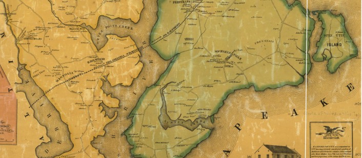
- Old Maps Online also has Brown University Library’s C. P. Hauducoeur’s engraving of the head of the Chesapeake and Susquehanna River. Of course, many more are found via this web portal.
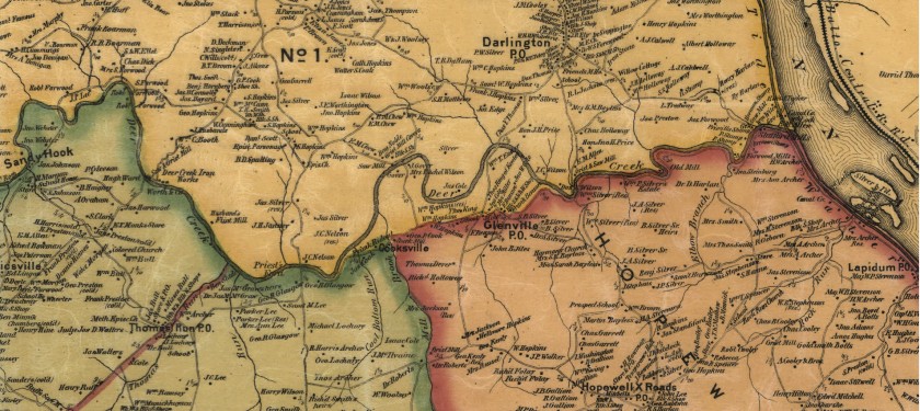
- The Library of Congress has L. W. Herrick’s Map of Harford County from 1858 and Martenet’s 1878 Map. It also has T.M. Fowler’s 1907 birds-eye-view of Havre de Grace.
- The Enoch Pratt Library has a subscription to the Sanborn Fire Insurance Maps. From the 1880s until about World War II, the cartographers for this company visited towns regularly to update drawings and produce sketches at a detailed scale of 1-inch to fifty feet. With these a researcher is able to observe the changes that took place with a dwelling or a community over generations. You need a Baltimore City Library card to access the database online.
- Here is a link to a union catalog, an index, of all the Sanborn Maps published for Maryland.
Check these resources out the next time you are working on a project and need Harford County Maps. Regardless of where your inquiry takes you you will find many other maps of interest as you start searching these and other databases.
- A portion of the map of the head of Chesapeake Bay and Susquehanna River by C. P. Hauducoeur; Source: The John Carter Brown Library at Brown University, via: Old Maps Online
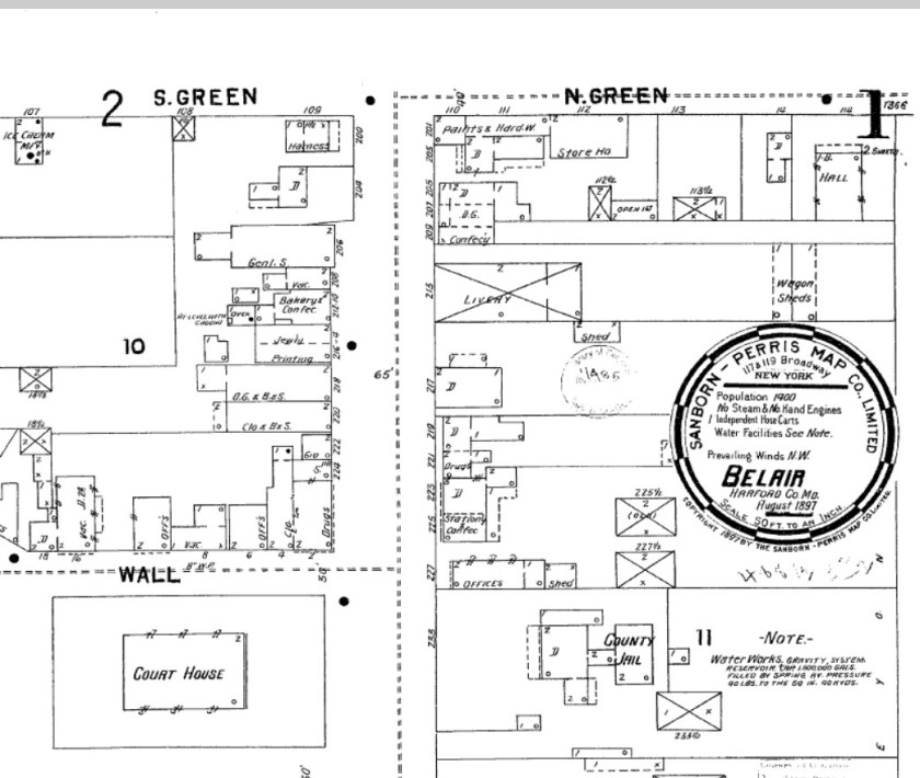
- Part of the Sanborn Fire Insurance Map of Bel Air, 1897; Source Enoch Pratt Library